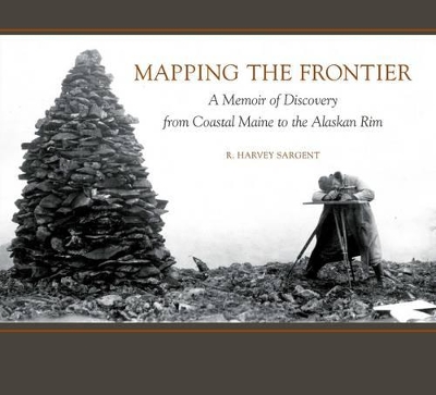
Alaska in 1900 was unexplored frontier, a land where risk, danger, and ultimate adventure made teamwork essential. Maine native R. Harvey Sargent led the U. S. Geological Survey in Alaska for over three decades, 1901-1936, charting the vast expanses of this remarkably beautiful and treacherous land. A pioneer of modern mapping, Sargent introduced 20th-century “firsts”: photogrammetry and aerial surveys in Alaska, and the first professional surveys of China’s mountainous interior.
Mapping the Frontier: A Memoir of Discovery from Coastal Maine to the Alaskan Rim publishes for the first time Harvey Sargent’s diary of his explorations in the world’s outer edges, from China to Mexico, Utah, Arizona, Montana, and Alaska. He was the son of a sea captain, born with exploration and adventure in his veins. Grounded in the foundations of his childhood home of Sedgwick, Maine, to his family residence for a half-century with USGS in Washington, D. C., Sargent’s lively narrative is beautifully illustrated with period maps and photographs. The reader will experience the breathtaking majesty of the Grand Canyon; the deadly harsh winters of Utah’s dessert; misty fjords and dramatic icebergs of Glacier Bay National Park; and Sargent’s discovery of Alaska’s Aniakshak crater, today the country’s most remote National Monument and Preserve.
Author R. Harvey Sargent of Sedgwick, ME, led the U. S. Geological Survey in Alaska, for 35 years. He also created the first modern maps of China, trekking across the country's interior during the treacherous post-Boxer Rebellion days in 1903-04. Recreating his story from maps, photographs, and his own copious journal entries, Mapping the Frontier is a great addition to the literature of discovery and adventure.
Papildus informācija
"For the last several centuries, mapping the unknown was the keystone of exploration. Harvey Sargent represented the best of the passionate genre of explorers. This book is a well-told story and stunningly illustrated. It is historic explorer landmark literature." --Alan H. Nichols President, The Explorers' Club
Foreword by Blue Hill Public Library
Prologue by Robert M. Sargent
1 Childhood in Sedgwick, 18751889
2 A Passion for Exploration, 18901895
3 The National Zoo, Washington, D.C., 18951898
4 Joining the Survey: South Dakota, Texas, Wyoming, Montana,
Arizona, 18981901
5 First Chief of Party: Glacier National Park, Montana, 19011903
6 The China Expedition, 19031904
7 Mapping and Marriage: Arizona, Utah, New Mexico, 19041906
8 Distant Journeys: Alaska, Mexico, 19061907
9 Alaskan Summers, Washington Winters, 19071909
10 Topographer in Charge of the Alaskan Branch: Matanuska Valley and
Kenai Peninsula, 19081911
11 Alaskas Matanuska Valley and Iliamna Bay, 19131914
Epilogue, 19151951
Alaska Today
Glossary & Bibliography
INDEX
Rufus Harvey Sargent was born in Sedgewick, Maine, in 1875, but his life and workwith the U.S. Geological Survey took him far from his home town on the coast. He explored and mapped some of the most remote parts of the world, including sections of Alaska and China that no one had ever set foot in. He completed the first aerial survey of Alaska in 1925-26, and in 1947 the Department of the Interior awarded Sargent its Medal for Distinguished Service. He died in 1951, in Washington, D.C.

 Biežāk uzdotie jautājumi par e-grāmatām